


Meteorologist Mike Stone answered questions in a Facebook LIVE video on the WTVR CBS 6 Facebook page. Click here to watch the video. Meteorologist Mike Goldberg is planning to answer your questions on Facebook LIVE tonight at 5:30 p.m. and 10:30 p.m.
RICHMOND, Va. -- The center of Hurricane Irma began grazing northern Cuba early Saturday morning. This allowed wind speeds to drop from 155 mph at 5 a.m. to 130 mph at 8 a.m. to 125 mph from 11 a.m. through 5 p.m.

Some strengthening is expected Saturday night into Sunday morning as it moves over ocean water temperatures near 90°.

The center of Irma will move across the Florida Keys and up through southwestern Florida on Sunday. A storm surge of 8 to 12 feet will impact the southwestern coast, as well as torrential rainfall.

Some sections in southern Florida may pick up over 15" of rain before the storm departs.

The track brings the storm up through northern Florida and into Georgia as it gradually weakens. It will move northwestward towards the Tennessee River Valley by mid-week as just an area of low pressure.

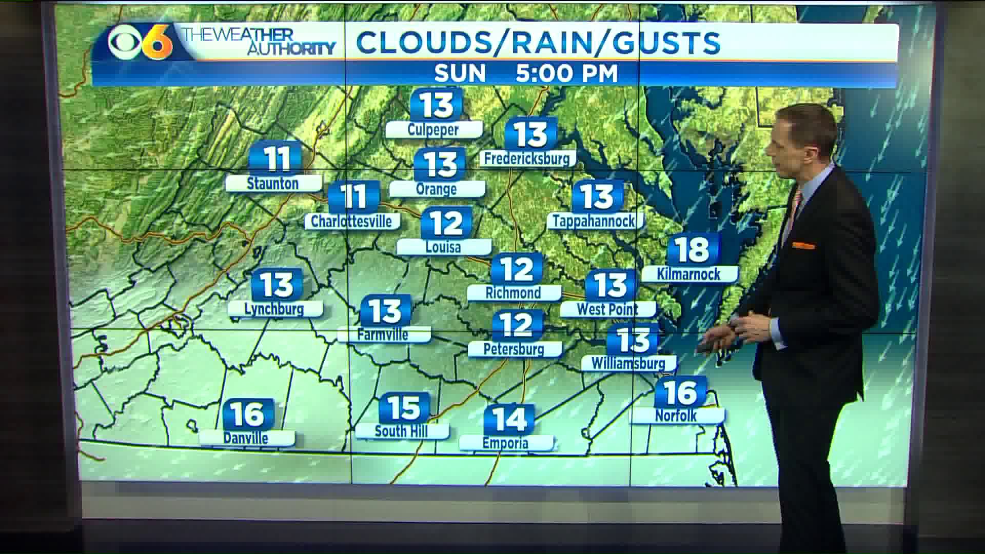
Since central Virginia will be far away from Irma, any impacts to our area will be minimal. We will see clouds increase from late Sunday through Monday. Rain showers will move up from the south Monday night into Tuesday morning.

Wind gusts will increase, but should stay below 40 mph for most of the state. The exception would be some of the higher elevations in southwestern Virginia. The storm's movement will allow the wind gust speeds to diminish late Tuesday into Tuesday night.
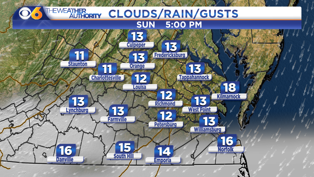
One impact from the winds coming out of the northeast, east and southeast will be the potential for minor coastal flooding in the Northern Neck and Middle Peninsula, mostly at high tide. Waves at Virginia Beach could approach 10 feet.

Rainfall amounts will not be too heavy. Here is one computer model, which is in the middle in terms of the rainfall amounts between the various computer models.

One computer model has Irma tracking even farther away from us, keeping rain totals below one-half inch. Another model has the storm a little closer with higher rainfall totals. At this point, while some areas may pick up an inch or a little more, many locations will likely fall into a half-inch to one inch range of rainfall. Southwestern Virginia will see the most rainfall, with over two inches possible.

The remnants of Irma will just be an area of low pressure by late in the week. Computer models bring this low into our area, and this just means there will be the chance of some showers without any strong wind gusts.
More updates will be posted on our weather page. The latest stats and track for Irma can also be found in the CBS 6 Hurricane Tracker.
CBS 6 Storm Team Links:

