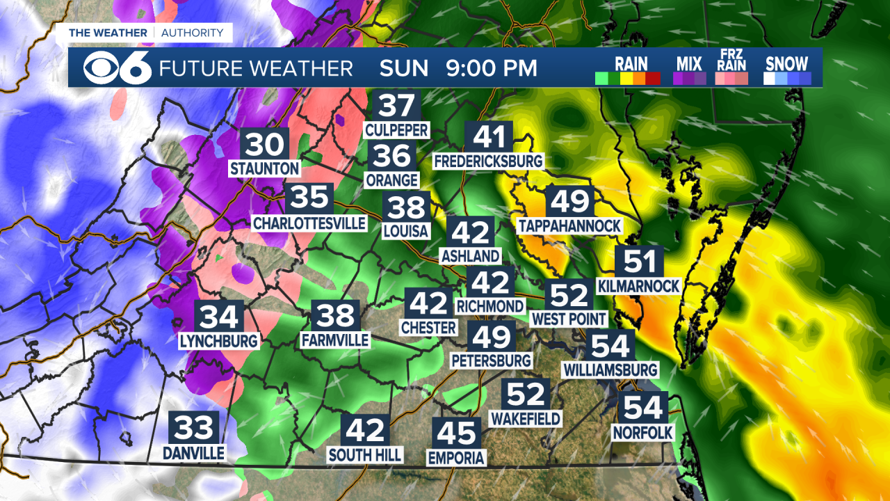
RICHMOND, Va. -- A large winter storm will track northward through the region into Sunday night. Click here for the latest winter alerts, which includes a winter storm warning for some counties.
Snow will push northward through the state through the afternoon.
As warmer air gets pushed in from the east and southeast, the snow will change to sleet, and then a period of freezing rain (rain that falls as liquid, but freezes upon impact with the ground).


Any wintry mix will transition over to all rain during the afternoon and evening. Winds will increase, with gusts over 30 mph possible in central Virginia, and over 40 mph at the coast.


We will see periods of heavy rain Sunday evening, which will scatter by around midnight.

Here is how the storm will affect different parts of Virginia:


Snowfall accumulations will be interesting. There will be a period of accumulation before the switch to a mix. After rain picks up, it will wash away a lot of the accumulation in the evening and at night. Untreated roads may be snowy and icy into the evening hours.
Here is the latest snowfall forecast. If the storm makes a subtle shift, that would bring the transition to a mix in an hour earlier or later, which would affect the snow totals.
The threat for freezing rain and icy conditions will increase from I-95 to the west and southwest.


As the storm exits early Monday morning, it will wrap colder air in behind it. A few flurries or snow showers are possible until around 9 a.m., mostly north of Richmond. The rest of the day will be dry, and dry weather will continue into Tuesday and Wednesday.
Stay With CBS 6, The Weather Authority.
STORM TRACKING LINKS:


