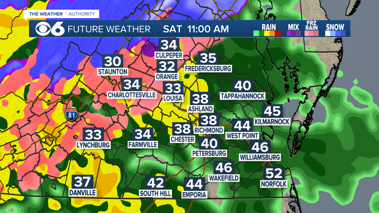
RICHMOND, Va. -- A storm will spread precipitation into the region Saturday morning. Temperatures in many locations will be near or below freezing.
CLICK HERE FOR THE LATEST WINTER ALERTS

Weather News
Hour-by-hour look at Saturday winter storm
There will be some warmer air above the surface, so while some locations may see some snow or sleet, the primary precipitation when it starts will be in the form of freezing rain. This is when liquid rain falls and then freezes on impact with surfaces at or below freezing. This is different from sleet, which is when snow melts into rain, and then refreezes into ice pellets.

Areas south and southeast of Richmond will just see rain from the storm.

In the metro, there could be a brief period of mix and/or freezing rain before temperatures warm above freezing.

Areas northwest and west of Richmond will see a longer period of freezing rain. This will create icy spots on untreated surfaces. A Winter Weather Advisory is in effect.

Farther northwest, there will be a higher chance of some mixed precipitation, and a longer period of freezing rain. Temperatures may not get above freezing until mid-afternoon. These areas will get some ice accumulation.

The mountains and areas near Interstate 81 will have the biggest travel issues in the state. There may be an accumulation of snow and sleet, with freezing rain creating an icy glaze on top. Winter Storm Warnings are in effect.

As temperatures warm from southeast to northwest in the afternoon, most areas will just see some heavy rainfall.


Rain will exit by Saturday evening.

Final rain totals could exceed an inch in some areas.

Sunday will be dry, but any wet and untreated surfaces Sunday morning will be icy.
Stay With CBS 6, The Weather Authority.
Download the new and improved CBS 6 Weather App for iPhone and Android.
STORM TRACKING LINKS:
Interactive Radar
Weather Alerts
Tropical Tracker
Map Center
Closings & Delays


