RICHMOND, Va. -- Severe storms developed in northern Virginia early Wednesday afternoon, moving past Washington, D.C., by 1:30 p.m. The first severe thunderstorm warning was issued just before 2 p.m. for winds of 60 mph.
The storms tracked southward, hitting Stafford and Spotsylvania counties by 2:30 p.m.
The cluster of severe storms intensified as it raced southward, at speeds between 40 and 50 mph.
By 2:53 p.m., the severe thunderstorm warning was upgraded to a "destructive" category, as the storm moved from Caroline County down into Hanover and King William counties. The winds with the storm were near 80 mph.
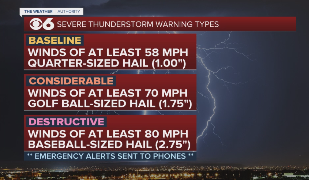
The National Weather Service now categorizes the types of severe thunderstorm warnings:

Most severe thunderstorm warnings are "baseline," which is a storm that has winds of 58 mph or higher, and/or hail one inch in diameter or larger.
The second tier of a severe thunderstorm warning is "considerable," which is for winds of 70 mph and/or golf ball-sized hail.
The top tier of a severe thunderstorm warning is "destructive," which is for winds of 80 mph and/or baseball-sized hail. Only around 10% of a year's thunderstorms nationwide fall into this category. This warning will also trigger alerts on mobile devices.
At 3:08 p.m., the National Weather Service in Wakefield extended the destructive severe thunderstorm warning into the Richmond metro area.
RELATED: Winds rip roof off apartment building in Richmond
At 3:39 p.m., winds within the storm had decreased to around 60 mph, and a baseline severe thunderstorm warning was issued for areas south of Richmond through the Tri-Cities.
The thunderstorm then weakened as it moved towards the North Carolina border after 4:30 p.m.
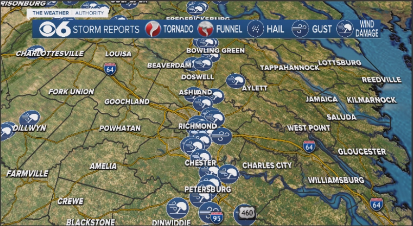
More than 100 severe weather reports were recorded by the National Weather Service Wednesday afternoon.


